

Breaking Barriers
Building Resilience

Differentiators
Reliably communicate anytime, anywhere and in all domains through the integration of multiple communication technologies.
Achieve interoperability and situational awareness between units with different equipage with our smart communication routing algorithms.
Seamlessly fuse data from all your sensors and technologies, including airborne, ground, static and mobile sensors with our data fusion algorithms.
Obtain a comprehensive situational awareness picture of all your assets and manage resource allocation with our interactive tools.
Enable fast and accurate decision-making using our actionable information tools based on cutting edge stochastic and machine learning prediction models.
No additional tools required: our system can be used through our SkyTL platform or integrated with your current system, such as the Tactical Awareness Kit (TAK) or enterprise level platforms.
Industries
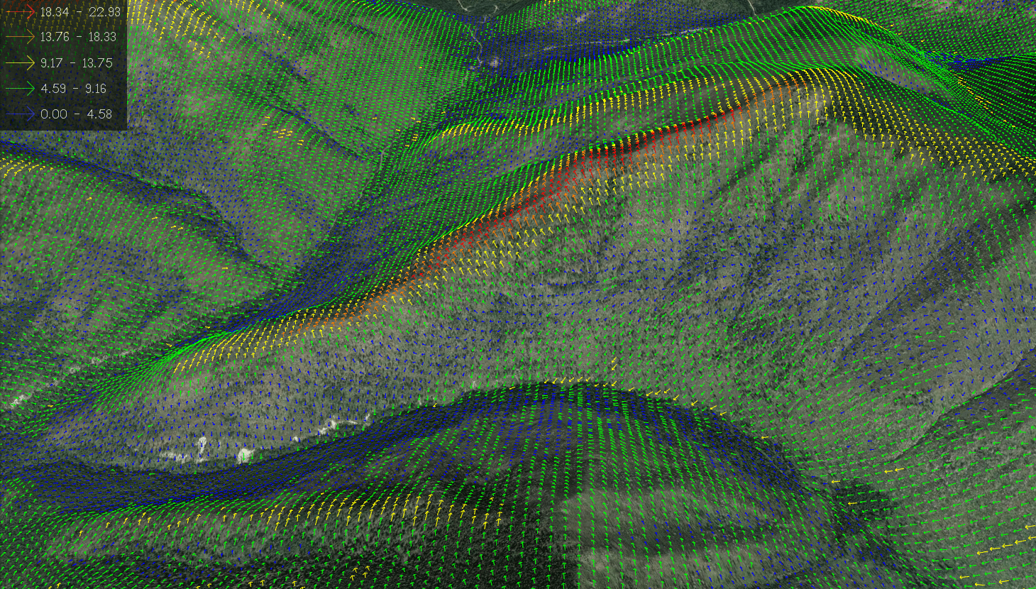
Wildfire
Water quality
defense
Meteorology
airports
uas
intelligence
Applications
emergency response
WindTL is a decision support tool that provides common operating intelligence for situational awareness and resource allocation management. Integrating multiple data sources and tracking devices, we aggregate all your inputs in one place for informed decision making. Our solution encompasses several layers that can be tailored to your needs.
- - Resource and Asset Tracking.
- - Wildfire and Ember Spread Model.
- - Real Time Integration of in situ Measurements in Prediction Models.
- - Manned and Unmanned Aircraft Deconfliction Model.
- - Integrated Risk Model based on Local Conditions.
- - Integration with 3rd party applications.
- - Identification of high-risk hotspots to inform resource allocation.

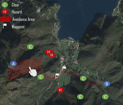
UAS Traffic Management
AirTL is a portable airspace deconfliction solution designed to monitor the operating environment of both manned and unmanned aircraft in areas with a decentralized communication infrastructure. Our solution is rapidly deployable and does not require cellular connectivity.
- - A proprietary algorithm to accurately track the locations and operating intent volumes of all UASs.
- - Early identification potential conflicts between aircraft.
- - Promptly alerts of conflicts.
- - A proprietary algorithm to provide deconflicting routes and operating volumes in real-time.
- - Fully integrated through ATAK for easy and fast deployment.
Military Field Operations
Our system provides field operators and commanders with a unified operational view and coordinates autonomous and human-in-the loop operations through a risk management system. The system consists of a robust mesh communication network that connects to a ground control hub that combines the data from multiple sources and distributes information. Operators, using a TAK interface, efficiently manage missions, receiving real-time updates for coordinated efforts.
- - Data fusion from multiple technologies for a synchronized operation.
- - A common operating picture of all actors that can be seen by any operator with an enabled device.
- - An interactive tool for users to allocate resources.
- - A risk-based model to assign risk scores to vehicles and missions.
- - Integration of multiple data links and intelligent routing of communications.
- - Secured encryption of data communications.
- - Interactive command and control through a user-friendly interface integrated through TAK.
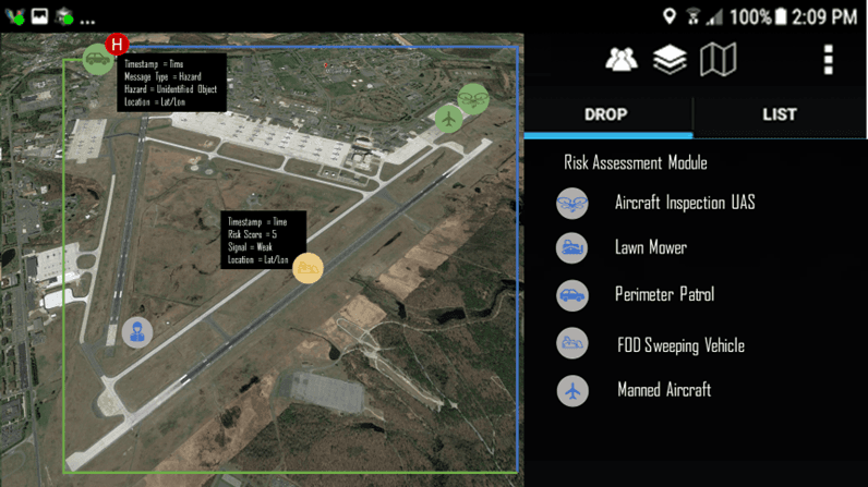
Airfield Management
In commercial airfield operations, the Agile Combat Employment (ACE) flight lanes, as well as airfield bases, ground and airborne robotics are entering the landscape. However, currently, airfield coordination systems often fall short. As robotic vehicles enter the landscape, coordination, synchronization, and risk mitigation are required to achieve a safe and efficient operation.
- - A unified operational view of the status of actors.
- - Monitoring of resources and personnel.
- - Warning of hazards and risk mitigation for off-nominal scenarios.
- - Collaboration between human operated and automated vehicles.
- - Data fusion from multiple technologies for a synchronized operation.
- - A risk-based model to assign risk scores to vehicles and missions.
- - An interactive tool for users to allocate resources.

Intelligence
An autonomous intelligence system to be deployed on-board UAS. Through this solution, UAS are equipped with optical and infrared cameras and edge computing machine learning to detect and autonomously track targets of interest (e.g., wildfire, assets, persons of interest, vehicles, etc.). Forming a robust mesh network, multiple UAS collaborate without a human in the loop and create intelligent flight formations to optimize the surveillance task.
- - Data fusion from multiple UAS into a single tracking algorithm.
- - A proprietary algorithm for collaborative decision making without a human in the loop.
- - A synchronized operation of multiple UAS based on intelligent flight formations.
- - A common operating picture of all actors that can be seen by any operator with an enabled device.
- - Secured encryption of data communications.
- - Visualization of the operation through a user-friendly interface.

Meteorology
Our communication infrastructure and data fusion technology merges weather information from multiple ground and airborne sensors to provide high resolution atmospheric data in events of limited communications and remote regions.
- - Low-cost communication of multiple weather sensors.
- - Identification of weather conditions from low-cost cameras.
- - Mesh networking of weather stations.
- - Integration with weather models and platforms.
- - Integration of weather data from UAS missions.